
Content Source: Polaris Interactive Digital Display (9928803 R01) > Features and Controls Chapter
| IMPORTANT |
|
The Owner's Manual for this vehicle contains warnings, instructions and other information you must read and fully understand before safely riding or performing maintenance on this vehicle.Always follow the warnings and instructions in Owner's Manual. Click the CONTENTS link above for the Table Of Contents, or download a full PDF of the Owner Manual in the Owner Support area of Polaris.com |
Select MAPS/TRAILS from the menu to:
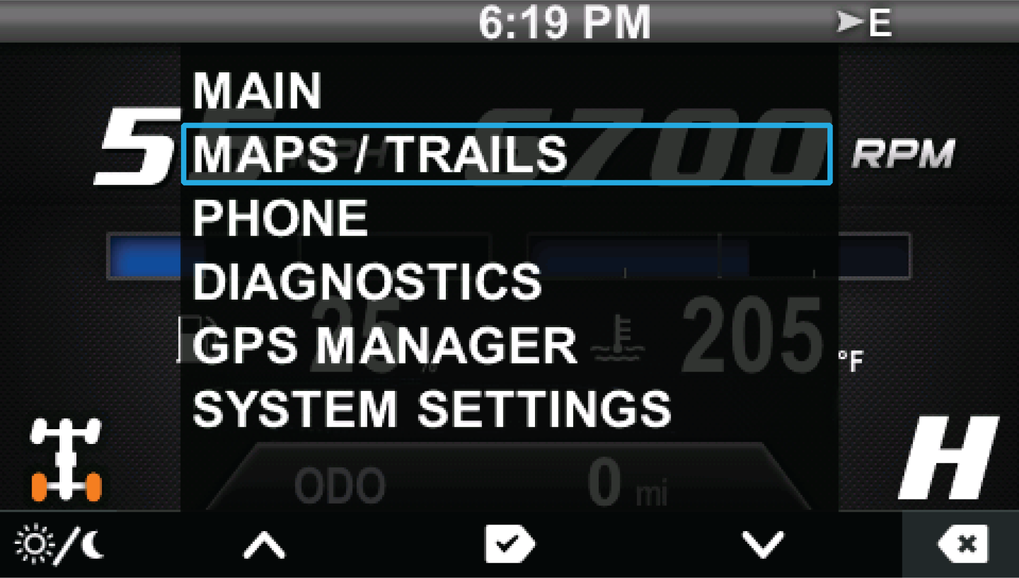
To view MAPS/TRAILS, do the following:
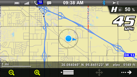
| Key | Function |
|---|---|
| Key 1 | Zoom out |
| Key 2 | Zoom in |
| Key 3 | Display menu |
| Key 4 | Pan (disabled above 10 MPH / 16 km/h) |
| Key 5 | Advance to next screen (GPS/Tracks Map) |
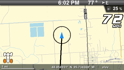
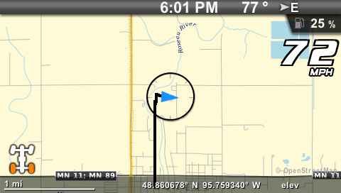
| Key | Function |
|---|---|
| Key 1 | Centers the map on your GPS location. The centering will occur after vehicle speed exceeds 10 MPH (16 km/h). Once the map is centered, key 1 toggles between COURSE UP and NORTH UP. |
| Key 2 | Places a marker at your GPS location. If your vehicle is stopped, the keyboard will display so you can name and save the waypoint. If your vehicle is moving, the waypoint will be placed and automatically named. Press and hold Key 2 to enter the Waypoint Manager menu. |
| Key 3 | Displays the keyboard to name and save the track. Up to 10 tracks can be saved. Press and hold Key 3 to enter the Track Manager menu. |
| Key 4 | Displays a confirmation message before clearing the current track. |
| Key 5 | Exit |
The arrow points towards the front of the vehicle and the map rotates around the center arrow. The direction the vehicle is traveling is displayed in the upper right hand corner. When in this mode, NORTH UP is shown for Key 1. selecting Key 1 switches display to NORTH UP mode.
The top of the map is North and the arrow rotates indicating the directions the vehicle is traveling. When in this mode, COURSE UP is shown for Key 1. Selecting Key 1 switches display to COURSE UP mode.
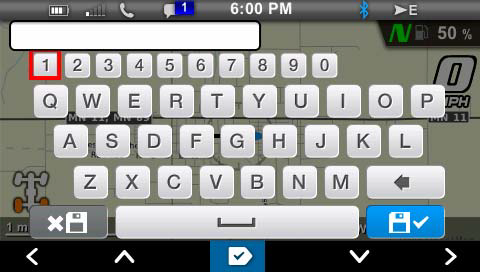
Use the display keys to navigate the keyboard.
| Key | Function |
|---|---|
| Key 1 |
Move left |
| Key 2 |
Move up |
| Key 3 |
Select the letter or number |
| Key 4 |
Move down |
| Key 5 |
Move right |
© Copyright Polaris Industries Inc. All rights reserved.